Why do certain regions register above-average disappearance rates?
Advertisements
The phenomenon in which certain regions register disappearances above average. It is attracting the attention of scientists, law enforcement officials, and search and rescue experts worldwide.
Geographical analysis of unsolved cases reveals patterns where hostile geography, structural failures, and social vulnerabilities intertwine. This is not an unfathomable mystery, but rather the physics of the terrain combined with the blind spots of the State.
Analyzing these points on the map requires setting aside the temptation of myths and facing cold, hard data, cartography, and the reality of rescue operations.
Summary
- The Impact of Geography and Terrain on Disappearances
- Social Factors and Failures in Search Infrastructure
- Countries and Areas with High Global Rates
- Real Data on Disappearances
- Modern Tracking Technologies and Methods
- Frequently Asked Questions (FAQ)
- Final Considerations
Why Does Extreme Geography Facilitate the Disappearance of People?
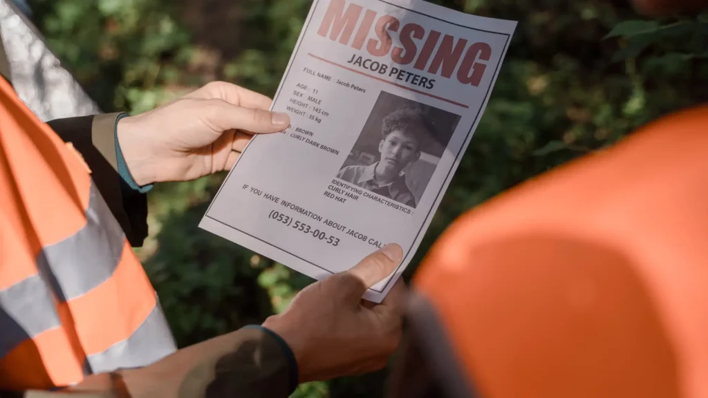
Dense forests, rock formations, and deserts do not forgive even the smallest navigational errors. Nature devours tracks with a speed that search logistics can rarely keep up with.
In continental reserves, such as the National Park Service In the United States, the illusion of safety on a marked trail crumbles at the first wrong turn.
A sudden change in temperature or a sudden fog is enough to disorient even experienced hikers.
There is a rarely mentioned psychological factor: blind panic. Upon realizing they are lost, the human tendency is to quicken their pace in the wrong direction, deepening their isolation before the alarm is even raised.
The dense vegetation acts as an optical shield. From above, a helicopter can only see the tops of the tree canopy, while on the ground, the rugged terrain swallows bodies and equipment into imperceptible crevices.
That's why these regions register disappearances above average.The hostile topography nullifies human senses and invalidates traditional location protocols within a few hours.
Beyond the terrain, the absence of cell phone signal turns the cell phone into a useless block of glass, severing the individual's only lifeline to civilization.
How do socioeconomic factors influence local statistics?
Not all disappearances happen in the woods. In urban peripheries and border areas, the geography that hides the problem is the absence of public policies and police overload.
The lack of lighting, the absence of cameras, and the dominance of criminal groups create opaque territories where a person's trail simply disappears without leaving official records.
There is also a criminal bureaucratic bottleneck: the lack of integration between state databases. If someone crosses an invisible border, they become a phantom statistic in the neighboring system.
The stigma associated with mental health crises or substance abuse causes families to delay seeking help from the police—and when they do, they find poorly equipped and skeptical offices.
The quick response, which should occur on the first day, is replaced by bureaucratic waiting, burying the chance of recovering images from security cameras or fresh testimonies.
Where are the places with the highest known global rates located?
Alaska, the Australian Outback, and the green expanse of the Amazon share the same diagnosis: relentless vastness combined with an almost non-existent human presence.
In Alaska, isolation is structural. The ratio of missing persons per capita is alarming, driven by a winter that erases any footprint in minutes and temperatures that kill by hypothermia in a few hours.
These deserted areas attract opposing profiles: the unprepared tourist seeking adventure and the individual who deliberately seeks to disappear from the social map.
When regions register disappearances above average., The map usually points to routes where the nearest medical help is days' walk or hours' flight away.
A simple mechanical failure on a secondary road in the Australian outback can turn into a death sentence by dehydration before anyone notices the traveler's absence.
++ The Mystery of Human Footprints Found in Unlikely Places
What is the real data on disappearances worldwide?
Cross-referencing global data exposes the stark difference between the reasons why someone disappears in a developed country versus a developing nation.
The following table compiles annual records and the dynamic forces behind the numbers in the most affected regions.
| Region / Country | Average Annual Number of Registrations | Predominant Geographic/Social Factor |
| United States (NCDC/NCIC) | ~500,000 to 600,000 cases | Expansion of national parks and urban mobility |
| Alaska (USA) | ~2,000 cases | Severe isolation, extreme cold, and dense terrain. |
| United Kingdom (Missing People) | ~170,000 cases | Mental health crises, the elderly, and youth runaways |
| Brazil (SINEPD) | ~70,000 to 80,000 cases | Urban violence, vulnerability, and flawed databases. |
| Australia (NMPCC) | ~38,000 cases | Arid vastness in the Outback and risky ecotourism |
A cold reading of the statistics confirms that the phenomenon adapts to the environment: in the concrete jungle or the desert, the gaps in the environment dictate the volume of cases.
The reasons why are clear? regions register disappearances above average., This shows that local infrastructure determines who gets found and who becomes a dead file.
Who are the most frequent victims in these high-risk areas?
The idea that only reckless adventurers or inexperienced explorers disappear in inhospitable environments is a dangerous misconception that masks the reality of the facts.
The data shows that elderly people with cognitive lapses, rural workers, local residents who rely excessively on their own memory of the terrain, and young children make up a massive portion of the official statistics.
In urban settings, vulnerability shifts to teenagers who have run away from their families, people experiencing severe mental health crises, and transportation workers who travel dangerous routes.
++ The Underground Tunnels That Nobody Knows Who Built
What is the role of community planning in reducing this impact?

Combating the rise in these statistics requires a profound change in attitude that goes far beyond activating sirens and helicopters after the tragedy has already occurred.
Communities living around national parks and high-risk border areas need to be trained as the first line of defense and early warning systems.
The creation of volunteer brigades trained in topographic mapping, combined with the prior registration of hikers and the installation of mandatory physical checkpoints, dramatically reduces the response time of official teams.
Similarly, organized neighborhood networks in cities can identify the absence of a vulnerable resident within hours, proving that social cohesion and collective preparedness are barriers as effective as the most advanced technological resources.
++ Historical records of improbable rainfalls: fish, stones, objects, and what is known today.
What technologies are currently helping to reduce these rates?
Human foot patrols are being replaced by swarms of drones equipped with thermal sensors capable of identifying the heat signature of a body beneath the forest canopy.
Artificial intelligence algorithms today analyze hours of satellite imagery to map variations in vegetation that indicate the passage of someone or makeshift campsites.
In urban environments, predictive facial recognition and cross-checking of banking and transportation data help track previously invisible movements.
That's how regions register disappearances above average. They are starting to turn the tables, trading the luck of visual search for analytical precision.
Personal satellite locators, now accessible to civilians, have eliminated dependence on the cellular network and changed the response time for rescue teams.
Nevertheless, the quickest tool remains clear information and the immediate reporting of the case by families to local authorities.
Frequently Asked Questions (FAQ)
Do I have to wait 24 hours to report a disappearance?
This is a dangerous myth. The report should be filed immediately upon noticing an unjustified disruption to the routine, as the first few hours determine the success of the search.
Why do national parks record so many incidents?
Because of a false sense of control. People underestimate the scale of nature, stray off the trails to take photos, and are surprised by the rapid loss of signal and changing weather.
How to prevent accidents in remote or high-risk areas?
Carry satellite communication, leave the detailed itinerary with someone outside the trip, and never rely solely on your phone's battery or map.
Final Considerations
Treating the disappearance of thousands of people as an unfathomable enigma is a convenient way to shirk social responsibility and investments in security.
Where the geography is harsh, rescue technology is lacking; where the environment is urban, integrated data and the political will to investigate thoroughly are lacking.
To consult official statistics and international guidelines on human rights and public security, visit the United Nations.
As long as the perspective on these territories is guided by sensationalism rather than technical prevention, the map will continue to accumulate shaded areas.