The lake that appears and disappears without apparent explanation.
Advertisements
Imagine traveling and finding a lake that appears and disappears mysteriously blending into the landscape as if it had never existed in that place?
This real hydrological phenomenon intrigues scientists and attracts thousands of curious travelers worldwide, challenging our perception of the Earth's own stability.
It's almost unsettling to realize that official cartographic maps often fail to define whether certain geographic coordinates contain dry land or deep water.
This lack of immediate visual answers has fueled local legends for centuries, transforming geography into living, ever-changing poetry.
In this article, we will unveil the geological secrets behind these ephemeral waters that defy the inattentive eyes of travelers.
You will understand the underground processes that defy common sense and learn about the most impressive examples on the planet.
Article Summary
- What defines this intriguing phenomenon?
- How does geology explain the disappearance of water?
- Why Lake Cerknica stands out globally
- When these events occur on the calendar
- What are the geological dynamics of a lake that appears and disappears?
- Comparative table of real data
- The future of these changing landscapes
- Frequently Asked Questions (FAQ)
What is the phenomenon of the lake appearing and disappearing?
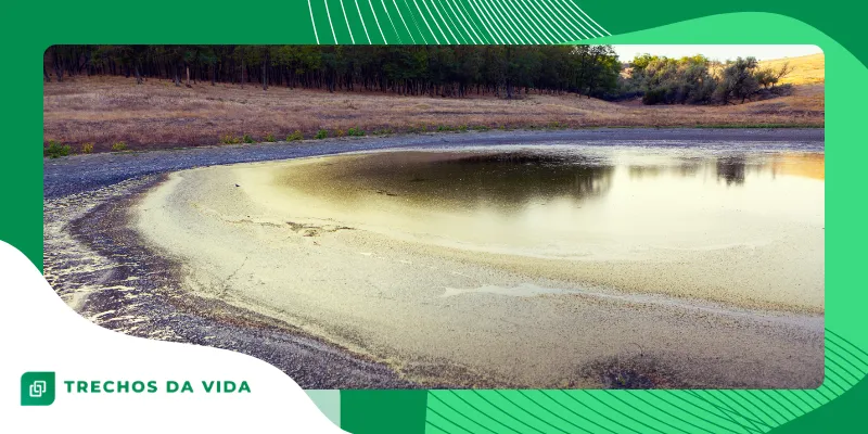
Intermittent or ephemeral lakes are bodies of water that undergo drastic cycles of emptying and complete flooding. Far from being mystical, the lake that appears and disappears It stems from specific climatic factors and structural dynamics.
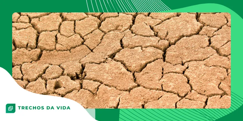
During periods of severe drought, the riverbed can transform into a lush green field navigable only by memories.
When the rains return, the landscape changes rapidly, filling geological depressions in just a few hours or days.
These unstable ecosystems harbor adapted biodiversity, capable of surviving extreme transitions between dry and wetlands.
Scientists constantly monitor these basins to understand the hydrological responses to recent global climate change.
There is something fascinating about the resilience of these species; they understand the rhythm of the planet better than we do.
They simply know when to retreat to the underground aquifers and when to return to the surface.
The dynamic landscape confuses those seeking a static and predictable natural environment for traditional tourism purposes. The unsuspecting traveler might find a dusty desert where, just the previous week, couples were kayaking.
This constant mutability redefines the concept of land ownership and agricultural frontier in these isolated regions.
What is productive pasture for cattle in May, transforms into a fish sanctuary in December.
How does hydrology explain the disappearance of these waters?
The technical explanation lies in karst, a type of landform characterized by the chemical dissolution of carbonate rocks. Acidic rainwater corrodes the limestone over millennia, creating complex underground channels.
When the water table rises due to heavy rainfall, the water emerges through veritable natural pressurized channels.
This process rapidly floods the surface, transforming dry plains into extensive reservoirs suitable for local wildlife.
Conversely, during droughts, hydrostatic pressure decreases severely and the terrain drains all the accumulated surface water.
The liquid returns to the underground aquifers through sinkholes, leaving the soil completely exposed and dry.
This dynamic acts like a vast natural hydrodynamic discharge, operating silently beneath our feet.
It is a vivid reminder that the Earth's surface is only the outer layer of a deeply interconnected system.
Hydraulic engineers often rack their brains trying to artificially replicate this flow efficiency, without success.
Nature has designed a perfect drainage labyrinth that does not suffer from silting or structural fatigue.
The speed of this underground drainage defies simple mathematical calculations of flow rates in conventional open channels.
Entire networks of caves act like giant sponges that suck up millions of liters in short intervals of time.
Read also: The mystery of the world of rare black hole explosions.
Why is Lake Cerknica the world's leading landmark?
Located in Slovenia, Lake Cerknica represents the most famous and studied example of an intermittent karst basin.
During the winter, it becomes the largest lake in the country, supporting villages and ecotourism.
In the summer, the landscape radically transforms into a fertile valley used for agriculture and communal grazing.
This fascinating cycle is documented in detail by Notranjska Regional Park, the institution that protects this European geological gem.
Advanced studies conducted in the region demonstrate how the cave system functions as a self-regulating natural plumbing system.
Predictable behavior attracts international researchers interested in hydrological modeling and severe environmental conservation.
The local community learned to live in symbiosis with this fluctuation, adapting their crops and boats to the mood of the rocks.
What seemed like witchcraft to ancient cartographers became routine and a means of livelihood for the local inhabitants.
Fishermen in this region have developed unique techniques to catch fish before the waters disappear through the rocky crevices. It's a race against time where geology itself dictates the rules of the food game.
Medieval Slovenian legends said that local witches controlled the invisible sluice gates of the lake for pure amusement.
Today, we know that gravity and limestone are solely responsible for this hydrological dance.
+ The city submerged in the lake of Guatemala for more than 2000 years
When do these emptying and filling cycles occur?
The frequency varies according to the local rainfall regime and the geological characteristics of each specific region. Generally, the filling coincides with the melting of mountain snow in the spring or intense seasonal storms.
Complete depletion usually occurs at the end of summer, accentuated by high evaporation rates and drought.
However, extreme climate anomalies recorded in recent years have significantly altered the historical regularity of these cycles.
In some isolated locations, the mystery lies in the apparent lack of immediate synchronization with visible surface rainfall.
This happens because the feeder aquifers can receive water from storms that occurred tens of kilometers away.
This visual disconnect is often misinterpreted by casual observers, generating myths about cursed or miraculous waters. The truth, however, lies for miles through dark galleries invisible to the human eye.
Predicting the exact date of the disappearance has become a challenge for meteorologists using cutting-edge artificial intelligence.
The behavior of deep aquifers involves variables that current human technology is not yet able to fully map.
This temporal uncertainty lends an added charm to ecotourism, which seeks authentic and ever-changing experiences. Visitors never find exactly the same landscape as someone who was there the previous month.
Look how interesting: How the discovery of a pterosaur reveals surprises from prehistoric science.
What are the geological dynamics of a lake that appears and disappears?
Besides the Slovenian giant, other locations share this intriguing characteristic of possessing a lake that appears and disappears.
In Ireland, "turloughs" are fields that turn into temporary lakes due to the characteristic limestone terrain.
Lake George, located in Australia, exhibits bizarre fluctuations that have lasted for decades, baffling local observers since the nineteenth century.
It can remain completely full for years and then suddenly dry up to the point of becoming pasture.
In North America, Medicine Lake in Canada empties annually through a complex system of underground rivers.
The water travels through hidden caves before resurfacing in streams located kilometers below in the mountain.
This global dispersion proves that the Earth's interior shares the same architectural solutions in different hemispheres.
This is a planetary drainage network that operates independently of our political borders.
These environments are extremely fragile, as any human interference with the sinks can cause the entire system to collapse.
A rock formation obstructed by agricultural or urban debris is enough to alter the hydrography of an entire region.
This is often misinterpreted by government officials who attempt to pave these areas without understanding the underground dynamics.
The result of these disastrous interventions is often catastrophic flooding in neighboring cities that should not receive this water.
Studying these phenomena helps us understand that the ground we walk on is not a solid, immobile block. It behaves more like a rigid sponge that breathes and reacts to the planet's climatic cycles.
Hydrological Data from Real Intermittent Lakes
Below, we have compiled technical information collected by official environmental monitoring agencies to illustrate the magnitude of these global phenomena as explained by science.
| Name of the Lake | Geographic Location | Main Mechanism | Average Emptying Time |
| Cerknica | Slovenia (Europe) | Karst Sinks | 3 to 4 weeks |
| Medicine | Alberta (Canada) | Underground Galleries | 2 to 3 months |
| George | New South Wales (Australia) | Evaporation and Failures | Decade Cycles |
| Turlough | County Galway (Ireland) | Water table flotation | 1 to 2 weeks |
The future of these changing landscapes
Unveiling the secrets of lake that appears and disappears It shows us how planetary dynamics are alive and surprising. Far from hidden forces, karst geology and hydrology masterfully explain these scenic transformations.
These ecosystems require rigorous preservation, as they are highly vulnerable to human activities and groundwater pollution. Understanding how these basins function helps protect vital water resources for future generations worldwide.
If you enjoy natural mysteries explained by science, continue exploring specialized portals like... US Geological Survey For fascinating discoveries. Share this knowledge with friends passionate about geography and adventure tourism.
Looking at these ever-changing plains makes us reflect on our own insistence on trying to fix and freeze nature. In the end, water always finds its ancient paths, however deep and dark they may seem.
The advance of global climate change adds a layer of urgency to the study of these highly sensitive watersheds. Prolonged periods of drought can render the sinkholes unusable, transforming these dynamic wonders into permanent dust deserts.
The international scientific community is racing against time to map all underground connections before they collapse. Preserving the invisible flow of water is essential to ensuring the survival of entire ecosystems on the surface.
Frequently Asked Questions (FAQ)
What makes a lake disappear out of nowhere?
The disappearance occurs mainly due to the karst topography, where water is drained through natural sinkholes and underground caves when the water table level drops.
Are there any intermittent lakes in Brazil?
Yes, there are temporary lagoons in the caatinga and karst regions of Minas Gerais and Bahia, which dry up completely during the prolonged dry season.
Do fish die when the water disappears?
Many adapted species bury themselves in the damp mud, waiting for the waters to return, while others lay hardy eggs that hatch only in the next flood.
Do climate changes affect these lakes?
Yes, global warming disrupts natural cycles, making drought periods longer and more unpredictable, threatening dependent local biodiversity.
Is it safe to walk on the dry beds of these lakes?
Yes, during the dry season the ground is usually firm enough for walking and grazing by local livestock.
How does the water return to the surface afterwards?
When rainfall replenishes deep aquifers, hydrostatic pressure pushes the water back up through the same rock openings.
Could these lakes disappear forever?
Yes, if underground sinkholes become blocked by sediment or structural collapses, the natural cycle of emptying and filling ceases permanently.